
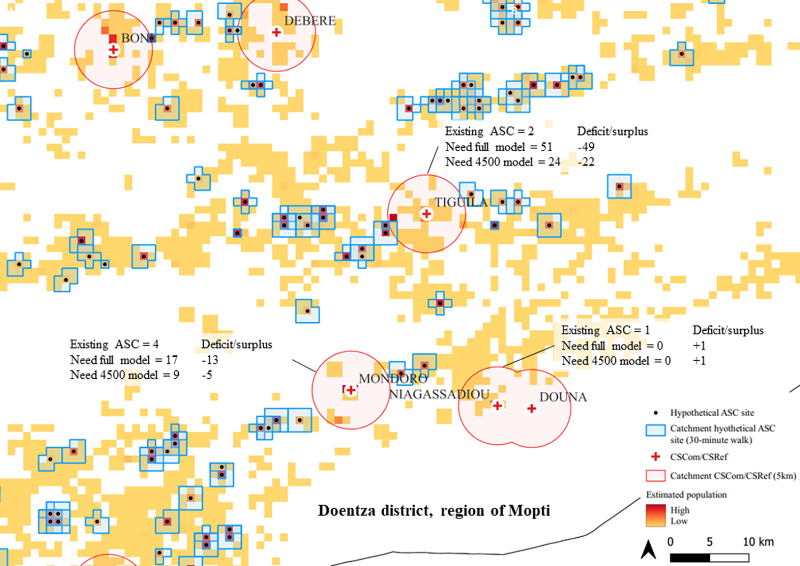
Optimising the scale and deployment of community health workers (CHWs) is important for maximizing geographical accessibility of integrated primary health care (PHC) services. Yet little is known about approaches for doing so. This research used geospatial analysis to model optimised scale-up and deployment of CHWs in Mali, to inform strategic and operational planning by the Ministry of Health and Social Development. Accessibility catchments were modelled based on travel time, accounting for barriers to movement. This geospatial analysis provides useful information to policymakers and planners in Mali for optimising the scale-up and deployment of CHW and, in turn, for maximizing the value-for-money of resources of investment in CHWs in the context of the country’s health sector reform. The geospatial analysis to model this research used AccessMod software, a Digital Public Good (DPG).