Problem Statement
Illegal, unreported, and unregulated (IUU) fishing undermines global fisheries management, biodiversity conservation, and economic sustainability. Responsible for losses exceeding $23 billion annually, IUU fishing depletes marine resources, destabilizes ecosystems, and disproportionately impacts small-scale fishing communities. Detecting and managing illegal fishing activities is particularly challenging due to the vast areas of ocean to monitor and the ability of illicit operators to evade traditional enforcement mechanisms. A scalable, data-driven approach is necessary to enhance monitoring and enforcement while promoting transparency in maritime activities.
How EO Can Help
EO technology offers a powerful tool for combating IUU fishing by providing monitoring and surveillance capabilities. By analyzing satellite imagery, EO can detect and track fishing vessels, identify suspicious activities, and monitor compliance with marine protected areas. This allows for more effective enforcement of fishing regulations and better management of marine resources.
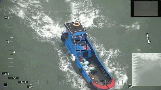
- Detecting and Monitoring Fishing Activity: Detection of suspicious fishing activity forms the foundation of an effective strategy to combat illicit, unreported, and unregulated (IUU) fishing. EO systems utilize a combination of Synthetic Aperture Radar (SAR) and optical data to identify vessels operating in unauthorized areas or without proper identification. Satellites such as Sentinel-1 and RADARSAT-2 provide all-weather, day-and-night radar imagery, enabling the detection of vessels regardless of lighting or cloud conditions. SAR imagery is particularly effective at locating "dark vessels" that turn off Automated Identification System (AIS) signals or Vessel Monitoring Systems (VMS) to evade detection. Algorithms process SAR data to pinpoint vessel shapes, locations, and movement patterns, that will provide insights around potential IUU activities. High-resolution optical data from Sentinel-2 and Landsat complements SAR by confirming certain behaviour, such as the deployment of fishing gear or course and speed through wake analysis. Visual analysis can help classify vessel types—such as trawlers versus transport ships—to determine whether their activities align with registered permissions. AIS data, and VMS data which tracks legitimate vessels transmitting location and activity information, is integrated with EO systems to cross-check vessel identities. This integration helps identify discrepancies or suspicious behavior, such as vessels turning off AIS transmitters, which is a common tactic used by IUU fishing operators.
- Classifying and Analyzing Risks: After detecting vessels, EO tools classify activities and assess risks to prioritize enforcement efforts. Machine learning algorithms analyze vessel movement patterns, such as loitering or zigzagging, to identify fishing activities in restricted areas. Historical data from platforms like Global Fishing Watch further aids in identifying patterns and pinpointing IUU fishing hotspots. Combining EO data with geospatial layers, such as MPAs, Exclusive Economic Zones (EEZs), and spawning grounds, creates detailed risk maps that highlight high-priority areas for enforcement. These assessments consider vessel behavior, the frequency of dark operations, and proximity to sensitive ecosystems, enabling authorities to allocate enforcement resources effectively and focus on the most critical areas of concern.
- Enforcing Laws: EO systems play a vital role in supporting enforcement operations and ensuring long-term compliance with maritime laws. Automated systems provide near-real-time alerts to enforcement agencies, enabling the rapid deployment of patrols or drones to intercept suspicious vessels. Platforms like SkyTruth and Global Fishing Watch integrate EO data to deliver actionable intelligence for enforcement teams, enhancing their ability to respond quickly and effectively. EO also aids post-incident processes by collecting evidence of illegal activities. High-resolution imagery and SAR data document the location, timing, and nature of suspected offenses, serving as critical evidence in legal proceedings. Persistent monitoring capabilities allow authorities to track flagged vessels over time, deterring repeat offenses and encouraging compliance. Public platforms such as Global Fishing Watch make fishing activity data accessible, promoting transparency and fostering accountability across the fishing industry.
Economic Impacts | Environmental Impacts |
Increases crop yields by up to 2.5% for certain crops through improved pest and disease management and variable rate application (VRA). | Reduces water usage by up to 25% and energy usage required for irrigation, further decreasing GHG emissions. |
Lowers operational expenses by as much as 25% when applying fertilizers and water more efficiently. | Facilitates the use of techniques like no-till that minimize soil disruption and can increase soil organic carbon stocks by 8%. |
Increases farm profitability by up to USD 50 per acre, depending on the crop and region. | Enhances soil health (indexed with the selected soil physiochemical and biological properties) by 45%. |
Improves market transparency, stabilizing food prices and reducing the risk of speculation and volatility. | Reduces excess water and chemicals that can runoff into nearby water bodies. |
Supports efficient allocation of resources for agricultural planning and food aid mobilization through more accurate production estimates. | Abates GHG emissions from nitrous oxide (N2O) by 39% which has 273 times the warming potential of CO2 by mass. |
Case Study: Monitoring Dark Fishing Activity in North Korean Waters
In 2020, Global Fishing Watch conducted an extensive analysis to monitor dark fishing activity in North Korean waters, utilizing the advanced satellite technologies and methodologies outlined in the image below.
Over a period of 40 days, spanning the squid fishing season from May to December, the team meticulously gathered and analyzed data. Key components of the analysis included daily observations of nighttime optical imagery and automatic identification system (AIS) vessel tracking data. Nighttime optical imagery was particularly valuable in identifying vessels operating without lights, a common tactic used to evade detection. By cross-referencing this imagery with AIS data, which tracks the movement and identification of vessels, the team was able to pinpoint suspicious activities and potential violations.
This use case was created with contributions from Global Fishing Watch.
