Problem Statement
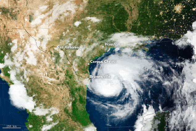
Environmental events such as hurricanes, earthquakes, floods, and wildfires often leave behind widespread damage to infrastructure, communities, and the environment. Rapid damage assessment is crucial for organizing timely relief efforts, restoring critical services, and protecting affected populations. Post-disaster response methods often rely heavily on ground surveys and human teams, which can be slow, resource-intensive, and difficult to deploy in hazardous conditions. Without timely data, decision-makers may struggle to assess the severity of the situation and prioritize areas of need. This gap in information can delay the allocation of resources during the critical early response phase, hindering the effectiveness of disaster recovery. Moreover, the lack of efficient post-disaster recovery planning can prolong the suffering of affected communities and delay the return to normalcy.
How EO Helps
EO technologies are powerful tools for post-disaster response and recovery, offering timely, large-scale insights that are essential for efficient damage assessment, resource allocation, and recovery planning. Satellite imagery, drones, and remote sensing technologies can quickly capture high-resolution imagery from disaster-affected areas, helping responders identify damage hotspots, assess the extent of destruction, and plan relief efforts. These technologies also support long-term recovery by continuously monitoring the progress of rebuilding efforts and the restoration of critical infrastructure.
- Damage Assessment and Impact Mapping: Satellites equipped with optical and radar sensors can assess damage across large geographic areas, providing timely imagery of affected regions. Post-disaster satellite imagery allows for the identification of damaged infrastructure, including collapsed buildings, flooded areas, destroyed roads, and disrupted utilities. For example, Synthetic Aperture Radar (SAR) can penetrate cloud cover and is particularly useful in disaster scenarios with poor visibility, such as during floods or hurricanes. By comparing pre- and post-disaster imagery, EO technologies enable the creation of precise damage maps. Machine Learning (ML) further enhances this process by automating the comparison of imagery, enabling quicker identification of patterns and anomalies in the data. This automation improves the accuracy and speed of damage assessment, helping to prioritize response efforts more effectively.
- Rapid and Cost-Effective Response: In disaster scenarios, rapid response is crucial, and traditional ground-based assessments can take days or even weeks. EO technologies provide a timely, cost-effective alternative by offering detailed insights in hours or days. These insights enable emergency responders and governments to deploy resources more effectively, focusing on the area’s most in need of intervention, and ultimately reducing the overall impact of the disaster on affected populations.
- Reconstruction and Recovery Planning and Monitoring: EO is invaluable for both disaster recovery planning and long-term monitoring. In the planning phase, EO provides pre-disaster baseline data and detailed risk assessments, enabling the identification of vulnerable areas and critical infrastructure requiring prioritization. Post-disaster, time-series satellite imagery supports the tracking of reconstruction progress for housing and infrastructure, revealing changes in the landscape, vegetation, and built environment. Techniques such as change detection analysis quantify recovery pace, while Land Use and Land Cover (LULC) change analysis highlights shifts in land use patterns, signaling the return of human activity and restored functionality. The Normalized Difference Vegetation Index (NDVI) further aids in monitoring environmental recovery through vegetation health and regrowth. Together, these insights ensure informed decision-making in recovery planning and effective monitoring of progress.
Economic and Financial Impacts | Environmental Impacts |
By identifying damaged infrastructure (roads, bridges, utilities) quickly, EO reduces the overall duration and costs of recovery by preventing misallocation of resources and speeding up the overall recovery process | EO technologies help assess environmental damage (e.g., deforestation, soil erosion, contamination) after a disaster, improving the efficiency of ecosystems restoration and protection. |
Reduction of downtime and disruptions to service of commercial sectors (e.g. transportation, agriculture) . | EO technologies can assess the impacts on ecosystems and biodiversity, helping to identify vulnerable species and habitats affected by disaster. This enables the development of restoration plans that not only address immediate damage but also align with long-term sustainability and conservation goals. |
Quick, accurate damage assessment through EO can expedite insurance claim processing. | By identifying and addressing environmental risks early, EO can help prevent large-scale displacement of communities due to secondary environmental hazards. |
Safely assessing areas that are too dangerous to access via ground surveys, such as zones affected by landslides or collapsed structures can reduce costs associated with deploying specialized personnel, mitigating risks of injury, and expediting the evaluation process. | Assessing earthquake damage efficiently with EO reduces heavy machinery use and personnel deployment, thereby reducing energy consumption and greenhouse gas emissions by minimizing on-site visits. |
Case Study: CEOS and the Haiti Recovery Observatory (RO)
In response to the devastation caused by Hurricane Matthew in 2016, the Committee on Earth Observation Satellites (CEOS) established the Haiti Recovery Observatory (RO) to support long-term recovery efforts through satellite data. Led by Haitian organizations including CNIGS, CIAT, and ONEV, the RO aimed to demonstrate the value of EO in post-disaster recovery. It leveraged satellite data to monitor the rebuilding of infrastructure, assess agricultural rehabilitation, and track the restoration of ecosystems such as Macaya Park and coastal mangroves. The RO also provided critical insights for improving disaster preparedness and resilience against future events.
This collaboration allowed for the integration of high-resolution imagery with other data sets, enabling timely decision-making and fostering innovation in recovery processes. The Haiti RO has since become a model for leveraging EO data in disaster management, illustrating its potential to guide recovery and enhance resilience in the face of future natural disasters.
Case Study: Rapid Earthquake Response with Synspective's SAR
On January 1, 2024, a 6.5 magnitude earthquake struck the Noto Peninsula in Ishikawa Prefecture, Japan, causing significant structural damage and displacing numerous residents. The urgent need for damage assessment and coordinated recovery efforts was paramount.
Synspective swiftly deployed its SAR satellite, StriX, to capture high-resolution images of the affected region. SAR technology was particularly effective due to its ability to penetrate cloud cover and capture detailed images regardless of weather conditions or daylight. Within three days of the earthquake, Synspective completed a full-area observation of the Noto Peninsula and automatically extracted surface deformation data. This rapid assessment enabled government and relief agencies to analyze changes in the ground surface using archived images and quickly understand the conditions in hazardous areas, facilitating more efficient planning of field investigations and relief operations. Additionally, the SAR data was made publicly available for transparency and broad access to vital information.