Problem Statement
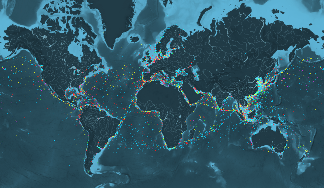
In the maritime industry, optimizing ship routes to ensure timely deliveries while minimizing fuel consumption and operational costs is a significant challenge. Without accurate and timely information about weather conditions, sea currents, and port congestion, shipping companies often resort to inefficient routing practices. Inefficiencies lead to increased fuel consumption, higher operational costs and contribute to environmental, as the shipping industry contributes nearly 3% of greenhouse gas emissions and marine pollution. Additionally, delays in shipments can disrupt supply chains, leading to financial losses and reduced customer satisfaction.
How EO Helps
Earth observation (EO) technologies offer vital solutions that can transform maritime operations by providing actionable information to shipping companies. Unlike traditional methods that rely on periodic reports and manual observations, the use of satellite imagery and enables continuous monitoring of sea conditions. This allows shipping companies to make informed routing decisions quickly, reducing the risk of delays and optimizing fuel consumption.
- Monitoring Ocean and Weather Conditions: EO data provides vital insights into the constantly changing ocean and weather conditions that impact ship navigation. Satellites like Sentinel-6 and Jason-3, whose data is publicly available, track surface heights, helping to map ocean currents that ships can use to save fuel and avoid rough waters. Wave height data allows ships can take advantage of favorable currents while avoiding rough seas. Monitoring sea surface temperatures (SST) influences fuel efficiency and cargo stability, and timely weather data reanalysis systems provide updates on wind patterns, storms, and precipitation. These tools enable ships to reroute around hazardous weather conditions, ensuring safety and operational continuity.
- Avoiding Hazards and Risks: EO technologies help shipping operators identify and avoid natural and human-made hazards, reducing risks to cargo and crew. Satellites penetrate cloud cover and provide detailed maps of sea ice extent and thickness, which is critical for optimizing routes in the Arctic and Antarctic regions. EO detects oil spills and algal blooms using optical and radar sensors, ensuring ships avoid areas that may damage hulls or pose environmental risks. Vessel detection algorithms applied to SAR data from Sentinel-1 help identify congested shipping lanes, allowing operators to choose less crowded, safer routes.
- Optimizing Routes for Efficiency and Sustainability: Integrating EO data with advanced analytics supports the development of fuel-efficient and environmentally friendly shipping routes. Algorithms use EO data inputs, such as ocean currents, wind speed, and wave height, to calculate the most efficient route in real time. This reduces fuel consumption and voyage duration.
Economic Impacts | Environmental Impacts |
Shorter and safer routes minimize operational costs, including fuel expenditure and potential delays from weather-related disruptions or hazards. | Increased route efficiency means shipping companies can lower fuel consumption by up to 3%, resulting in reduced costs and direct abatement of GHG emissions. This aligns with International Maritime Organization (IMO) regulations targeting a 50% reduction in emissions by 2050. |
Avoiding delays and hazards further enhances reliability and in turn profitability for shipping operators. | Reduced fuel consumption results in lower carbon dioxide (CO2), sulfur oxide (SOx) and nitrogen oxide (NOx) emissions. |
Case Study: From Satellites to Sea Routes: How EO Keeps Greenland Connected
Everything about Greenland is affected by ice. As the largest, non-continental island, communities in Greenland are themselves islands in an inhospitable climate. There are no roads connecting the settlements to each other and all transport is by sea, by air or across the land-fast sea-ice.
All goods coming to the island arrive by the sea-bridge provided by the shipping company Royal Arctic Line (RAL). RAL describe themselves as a “piece of infrastructure” and has a sole concession to transport goods to and from the port of Alborg in Denmark to Greenland. Without RAL, life in Greenland would be very basic for its 56,000 inhabitants.
RAL ships use the ice-mapping services provided by the Danish Meteorological Institute (DMI) to help navigate through the sea-ice which affects Greenland waters all the year round. The service helps them to avoid waters with high iceberg concentrations and to find the open water through which they can sail more rapidly and more safely. For the last few years, the ice-maps are generated using data coming from the European Copernicus Sentinel satellites.
As well as RAL, the ice services help the local fishing companies Royal Greenland and Polar Seafood to operate more effectively and more safely as well as for other vessels sailing in Greenlandic coastal regions ie cruise ships. This enables benefits through cost reduction, better efficiency and better safety. Overall, Greenland is estimated to benefit by between €8.6m and €12.5m each year from the use of Copernicus.