Problem Statement
Water availability is a critical concern in many regions, especially those dependent on seasonal snowpacks for a steady water supply. Snowpacks, which store vast amounts of water in frozen form, melt and release water into streams and rivers, sustaining agriculture, hydropower, and ecosystems. However, snowpack levels are increasingly variable due to climate change, leading to concerns over water shortages, unpredictable flow patterns, and hydrological imbalances. Efficiently monitoring snowpacks is essential to forecast water availability, manage resources, and mitigate droughts and flood risks. Traditional monitoring methods involves using a snow probe (a long pole with a weighted end) to measure snow depth or snow cores are sometimes extracted to measure snow water equivalent which measures how much liquid water the snow would release when it melts. These methods only provide spot measurements at specific locations, often far from observation points, and are not effective in monitoring large areas.
How EO Helps
EO technologies offer robust tools to monitor snowpack dynamics and predict seasonal water availability. By employing satellite imagery, remote sensing, and advanced data analytics, EO allows for up to date observation and analysis of snow-covered regions. While cloud cover is a common barrier for satellite imagery, advanced techniques have been developed to mitigate this. For example, the Snow Observation from Space Algorithm successfully reduced cloud interference in satellite images over Switzerland by nearly 50%, while maintaining an overall accuracy of more than 95%. These insights empower water resource managers, hydrologists, and policymakers to make informed decisions about water distribution, reservoir management, and flood prevention.
- Monitoring Snowpack Accumulation and Melt Patterns: EO technologies, through tools like Microwave Radiometer, Synthetic Aperture Radar (SAR), medium to low resolution visible and infrared range wavelength optical imagers, and snow indices such as the Normalized Difference Snow Index (NDSI), enable rough to precise (spatially 1km to 1m, temporally monthly to daily – depending on satellite specification) monitoring of snowpack accumulation, density, and melt patterns. High-resolution satellite imagery reveals changes in snow cover extent and depth, allowing experts to assess when snow begins melting and how quickly it will release water. In regions reliant on snowmelt, such as the western United States and parts of Europe, EO data provides an invaluable indicator of spring and summer water availability, helping to mitigate drought risks and support water allocation.
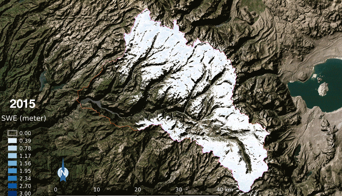
- Predicting Streamflow and Reservoir Inflows: EO data can be combined with hydrological models to estimate streamflow and reservoir inflows, providing a forecast of water availability across different seasons. Remote sensing data on snowpack depth and density, when coupled with temperature and precipitation data, allows hydrologists to predict water volumes entering reservoirs, informing water release schedules for agricultural and municipal use. For example, by assessing snowpacks in the Sierra Nevada mountains, EO-driven models can project inflows into California’s reservoirs, aiding in the management of water resources to prevent shortages and optimize water distribution across agriculture and urban needs.
- Assessing Flood Risks: In regions where, sudden snowmelt can lead to flooding, EO technologies provide early warnings by continuously monitoring snow cover and melt rates. However, the temporal resolution of satellites like Sentinel-1 (approximately 6 days) and Landsat (approximately 16 days) is insufficient to track rapid snowmelt events accurately. Therefore, EO observations must be coupled with in situ monitoring or land surface modeling to allow authorities to predict potential flood events and coordinate timely responses. This combination is not just beneficial, it's necessary.
Economic Impacts | Environmental Impacts |
Using EO for snowpack monitoring can reduce operational costs by providing accurate water availability forecasts and reducing the need for manual surveys. | Early warnings of rapid snowmelt help reduce flood damage by enabling timely, proactive measures. |
Reliable snowmelt predictions improve water availability forecasts reducing the economic losses from water shortages and enabling stable crop production planning. | Predictive water flow management based on snowpack data supports sustainable water use, helping maintain water levels in rivers and lakes that are critical for biodiversity. |
Case Study: How Colorado Uses Satellites to Secure Water Future
Colorado leverages satellite imagery to monitor snowpack by utilizing data from satellites such as the Moderate Resolution Imaging Spectroradiometer (MODIS) on NASA's Terra and Aqua satellites. These satellites provide high-resolution images that help identify snow-covered areas and estimate the extent of snow cover across large regions. MODIS captures data on snow cover, snow albedo (reflectivity), and snow grain size, which are essential for understanding the snowpack's characteristics and behavior. This satellite data is crucial for managing water resources and forecasting water availability, particularly in the Colorado River basin, which supplies water to multiple states.
To achieve a comprehensive picture of snowpack conditions, Colorado combines satellite data with ground-based measurements from the Snow Telemetry (SNOTEL) network operated by the Natural Resources Conservation Service (NRCS). SNOTEL stations are equipped with sensors that measure snow depth, snow water equivalent (SWE), temperature, and precipitation, providing real-time data that complement the broader spatial coverage of satellite imagery. By integrating satellite and ground-based data, Colorado can develop more accurate models for water resource management, allowing for better forecasting of water availability, aiding in the allocation of water resources, drought management, and flood risk mitigation. Additionally, the data supports environmental conservation efforts by monitoring snowpack health and its impact on ecosystems.
The National Oceanic and Atmospheric Administration (NOAA) significantly contributed to the development of this use case.
